

Petra & Wadi Rum
Petra (Arabic: البتراء, Al-Batrāʾ; Ancient Greek: Πέτρα) is a historical and archaeological city in the southern Jordanian governorate of Ma'an that is famous for its rock-cut architecture and water conduit system. Another name for Petra is the Rose City due to the color of the stone out of which it is carved.
Established possibly as early as 312 BCE as the capital city of the Nabataeans,
it is a symbol of Jordan, as well as Jordan's most-visited tourist attraction.
It lies on the slope of Jebel al-Madhbah (identified by some as the biblical Mount Hor) in a basin among the mountains which form the eastern flank of Arabah (Wadi Araba), the large valley running from the Dead Sea to the Gulf of Aqaba. Petra has been a UNESCO World Heritage Sitesince 1985.
The site remained unknown to the Western world until 1812, when it was introduced by Swiss explorer Johann Ludwig Burckhardt. It was described as "a rose-red city half as old as time" in a Newdigate Prize-winning poem by John William Burgon. UNESCO has described it as "one of the most precious cultural properties of man's cultural heritage".
Petra was chosen by the Smithsonian Magazine as one of the "28 Places to See Before You Die".
Wadi Rum has been inhabited by many human cultures since prehistoric times, with many cultures–including the Nabateans–leaving their mark in the form of rock paintings, graffiti, and temples.
In the West, Wadi Rum may be best known for its connection with British officer T. E. Lawrence, who passed through several times during the Arab Revolt of 1917–18.
In the 1980s one of the rock formations in Wadi Rum was named "The Seven Pillars of Wisdom" after Lawrence's book penned in the aftermath of the war, though the 'Seven Pillars' referred to in the book have no connection with Rum.
The area is centered on the main valley of Wadi Rum. The highest elevation Jordan is Mount Um Dami at 1,840 m (6,040 ft) high, located 30 kilometers to the south of Wadi Rum village. It was first located by Difallah Ateeg, a Zalabia Bedouin from Rum. On a clear day, it is possible to see the Red Sea and the Saudi border from the top.
Jabal Rum (1,734 metres (5,689 ft) above sea level) is the second highest peak in Jordan and the highest peak in the central Rum, rising directly above Rum valley opposite Jebel um Ishrin, which is possibly one metre lower.
Khaz'ali Canyon in Wadi Rum is the site of petroglyphs etched into the cave walls depicting humans and antelopes dating back to the Thamudic times. The village of Wadi Rum itself consists of several hundred Bedouin inhabitants with their goat-hair tents and concrete houses and also their four wheel vehicles, one school for boys and one for girls, a few shops, and the headquarters of the Desert Patrol
Monkeying Around in Gibraltar
Gibraltar (/dʒɨˈbrɔːltər/),[7][8] is a British Overseas Territory located on the southern end of the Iberian Peninsula at the entrance of the Mediterranean. It has an area of 2.3 square miles (6.0 km2) and a northern border with the Province of Cádiz in Andalusia, Spain. The Rock of Gibraltar is the only landmark of the region. At its foot is the densely-populated city area, home to almost 30,000 Gibraltarians and other nationalities.[9]
An Anglo-Dutch force captured Gibraltar from Spain in 1704 during the War of the Spanish Succession on behalf of the Habsburg pretender to the Spanish throne. The territory was subsequently ceded to Britain "in perpetuity" under the Treaty of Utrecht in 1713. It was an important base for theRoyal Navy; today its economy is based largely on tourism, online gaming, financial services, and shipping.[10][11]
The sovereignty of Gibraltar is a major point of contention in Anglo-Spanish relations as Spain asserts a claim to the territory.[11] Gibraltarians overwhelmingly rejected proposals for Spanish sovereignty in a 1967 referendum and again in 2002. Under the Gibraltar constitution of 2006, Gibraltar governs its own affairs, though some powers, such as defence and foreign relations, remain the responsibility of the UK Government.
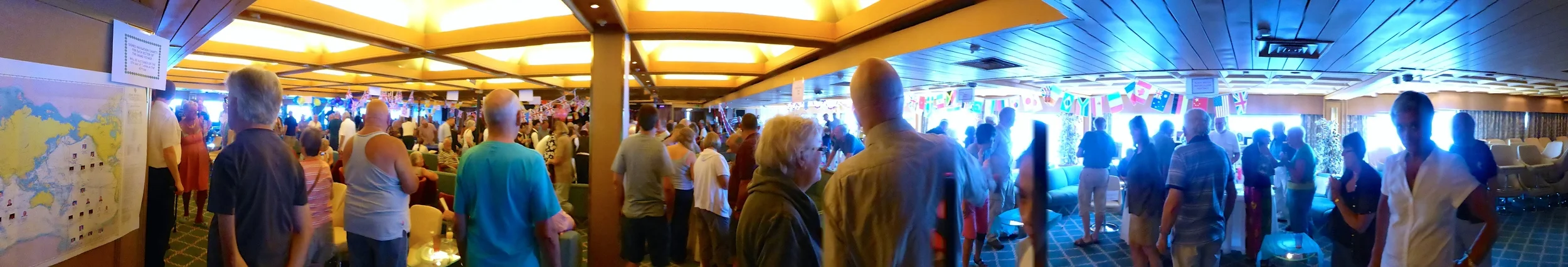
Black Watch Country Fair
Black Watch is a cruise ship, currently owned and operated by Fred. Olsen Cruise Lines. She was built by Wärtsilä Helsinki New Shipyard,Finland for Royal Viking Line as Royal Viking Star, entering service in 1972. She has also sailed for Norwegian Cruise Lines as Westwardand Royal Cruise Line as Star Odyssey.